
Through the Lens in Death Valley: A Photographer's Guide to Earth's Most Dramatic Landscape
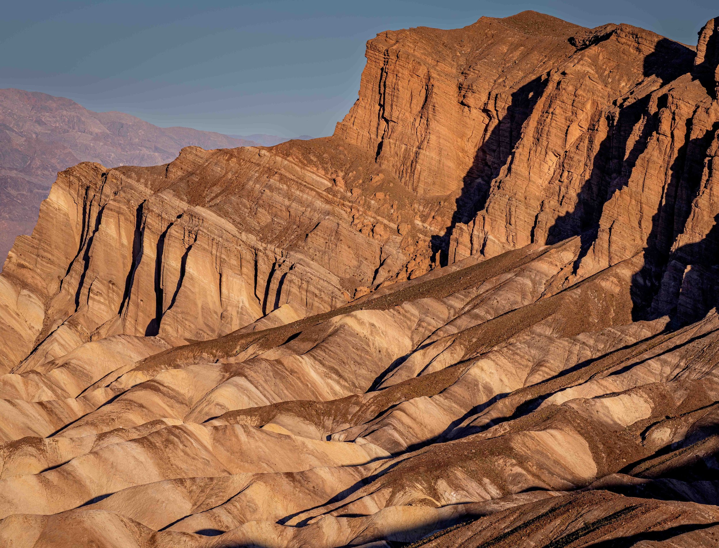
Sunrise at Zabriskie Point
There are landscapes that simply defy description. Places where the earth looks less like something you live on and more like something you've dreamed up. Death Valley National Park is one of those places. The first time you raise a camera here, you quickly realize that no single frame can hold it all: the vast salt flats stretching toward distant mountain ranges, the cracked and rippled textures at your feet, the way the light shifts from pale gold to deep amber in a matter of minutes. Death Valley doesn't just reward photographers, it humbles them, then rewards them anyway.
This is a place where patience and timing matter above almost everything else. But before we talk about the light, let's talk about the land itself.
A Brief History of Death Valley National Park
Death Valley's human story stretches back at least 9,000 years, when the Timbisha Shoshone people made this seemingly inhospitable desert their home. Remarkably well-adapted to the environment, they developed seasonal migration patterns that allowed them to thrive across the valley and surrounding mountains. Their presence is still felt today. In 2000, the Timbisha Shoshone were formally granted a permanent land base within the park, a recognition that was long overdue.
The valley's dramatic name came courtesy of a group of California-bound emigrants who crossed it in the brutal winter of 1849–1850. Though only one member of the party died during the crossing, as they crested the mountains and looked back, one woman reportedly said, "Goodbye, Death Valley" and the name stuck.
In the late 1800s, borax mining transformed the region economically. The famous Twenty-Mule Teams, which hauled borax wagons 165 miles to the nearest railroad, became one of the most iconic images of the American West. Remnants of this mining era can still be found throughout the park, adding a layer of industrial history to the geological one.
Death Valley was designated a National Monument in 1933 and elevated to National Park status in 1994. Today it is the largest national park in the contiguous United States, covering over 3.4 million acres. It also holds the record for the highest reliably recorded air temperature on Earth, 134°F, recorded at Furnace Creek on July 10, 1913.
Interesting Facts About Death Valley
Death Valley sits within the Mojave Desert and is classified as a hot desert, receiving less than 2 inches of rain per year on average.
Badwater Basin, at 282 feet (86 meters) below sea level, is the lowest point in North America.
Despite the extreme conditions, the park supports over 1,000 plant species, 400 animal species, and 36 endemic species found nowhere else on Earth.
In rare wet winters, wildflower superbloom events can carpet the valley floor in vivid color. One of nature's most unexpected spectacles.
The park contains vast geological diversity: sand dunes, salt flats, volcanic craters, canyon slot formations, and colorful mineral deposits all exist within the same borders.
Photographic Highlights in Death Valley National Park
During my visit I focused on several locations that capture the essence of Death Valley from quiet sunrise overlooks to iconic rock formations.
Zabriskie Point: Chasing the Sunrise
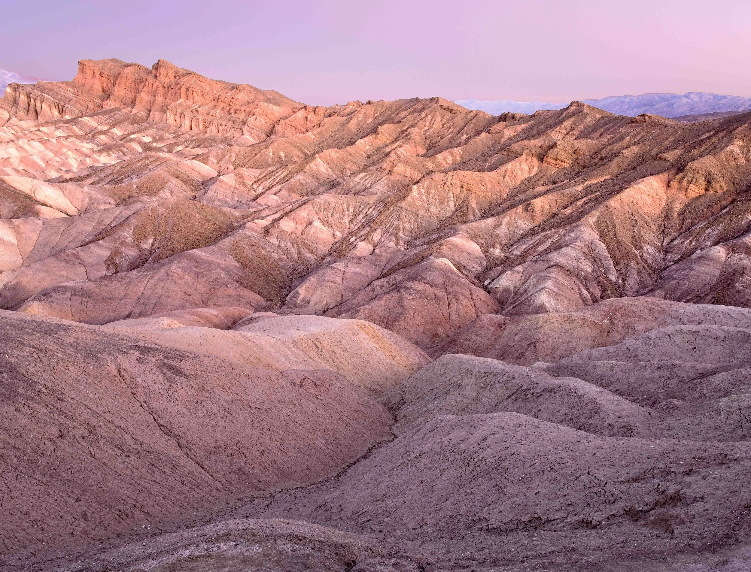
First light at Zabriskie Point — the badlands come alive in shades of gold, ochre, and rust as the sun clears the Amargosa Range.
If there is one location in Death Valley that every photographer puts at the top of their list, it is Zabriskie Point. And the reason is almost always the same: sunrise.
The landscape here is composed of ancient lakebed sediments, compressed over millions of years and then folded, eroded, and weathered into a series of ridges, gullies, and sharp badland formations. The colors embedded in these sediments, rust, ochre, caramel, pale cream are always present. But at sunrise, when the first horizontal light rakes across the ridges and throws every fold into dramatic shadow and highlight, they become something extraordinary.
The ideal setup is arriving at least 30 to 40 minutes before sunrise. The overlook platform offers a wide, sweeping view, but for more compelling compositions, explore the trails that descend into the badlands themselves. Getting lower and closer to the textured foreground creates depth and scale that simply isn't possible from the railing above.
One of the most satisfying things about Zabriskie Point is how the light changes minute by minute. The soft pre-dawn blue gives way to warm pink alpenglow on the distant peaks, then suddenly the sun breaks the horizon, and the entire scene shifts from cool to warm in seconds. Work quickly, his window is brief and it doesn't repeat.
Mornings here can be cold, especially in winter months, so dress in layers. And don't neglect the walk back to the parking area as the sun rises higher and the soft, low-angle light at your back illuminates the Panamint Mountains with equal beauty.
Devil's Golf Course: Texture at Its Most Extreme
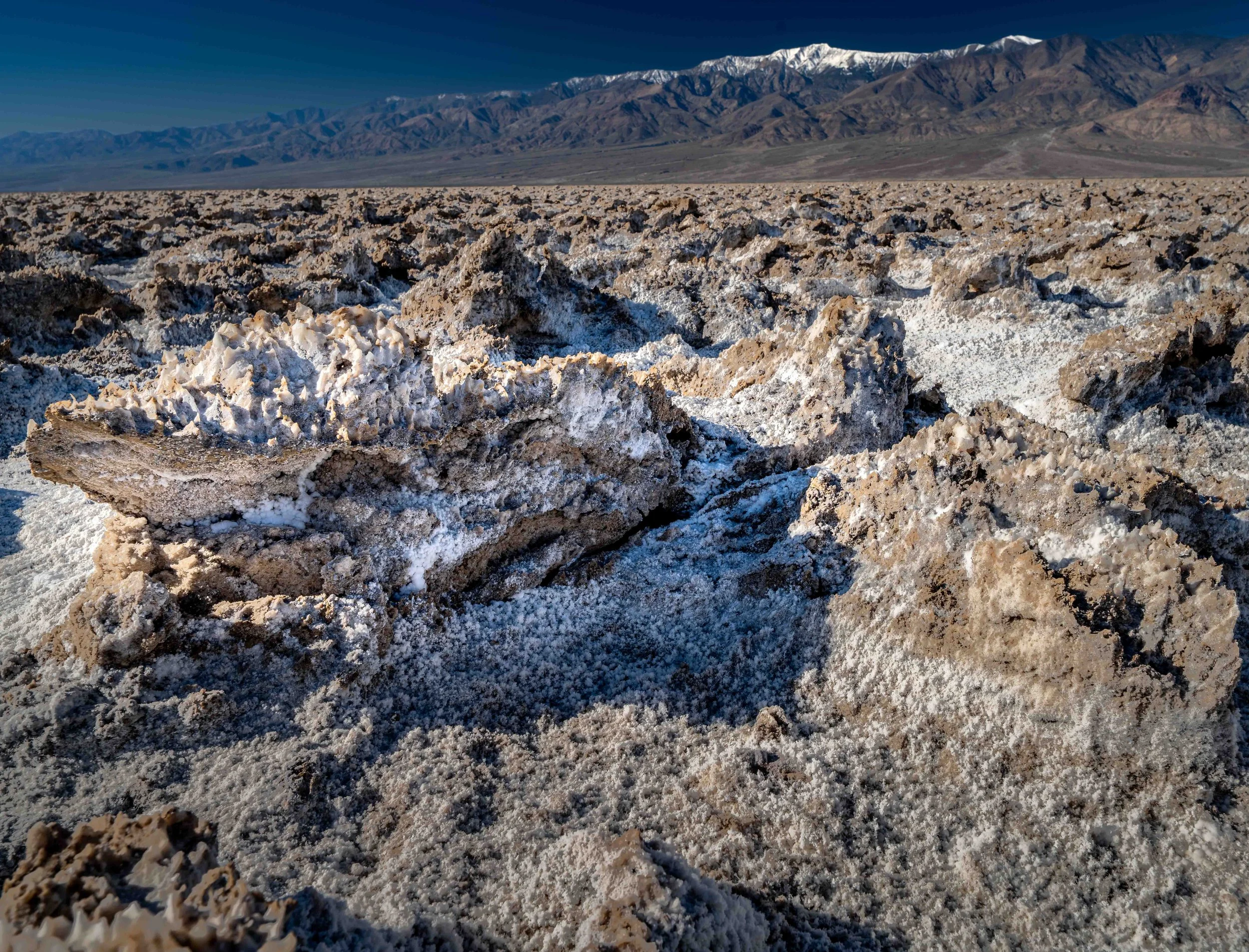
Nature's most hostile terrain up close — the razor-sharp salt pinnacles of Devil's Golf Course stretch endlessly across the valley floor, sculpted by centuries of flooding and evaporation.
The name alone tells you something about what to expect. A 1934 National Park Service guidebook described this area as the only golf course where "only the devil could play golf" and once you see it, the joke lands immediately.
Devil's Golf Course is an expansive field of halite (rock salt) crystals covering much of the central valley floor. The formations you see are the result of a remarkable geological process: ancient Lake Manly, which once filled Death Valley to a depth of around 600 feet, evaporated and left behind enormous salt deposits. Over time, rare rainfall events dissolve the surface slightly and then evaporate quickly, allowing new salt crystals to grow. This cycle, repeated over thousands of years, has produced the jagged, chaotic, almost alien formations that cover the landscape today.
From a distance, the field looks almost uniform, a pale, rough expanse. But get close, and the detail is remarkable. The pinnacles are sharp enough to cut skin, honeycombed with air pockets, and constantly crackling and popping as temperature changes cause the salt to expand and contract. Yes you can hear the landscape moving.
For photography, this location rewards patience and a willingness to get low. A wide-angle lens close to the formations exaggerates their scale against a wide sky. Midday light, often avoided elsewhere, works surprisingly well here. The harsh overhead sun creates deep shadows in the crevices and makes the white salt glow. Early morning and late afternoon light warm the crystals to a beautiful pale gold.
The textural contrast between the sharp foreground formations and a soft, hazy sky or distant mountain range makes for compelling compositions. Bring knee pads if you want to get down into the formations and wear closed-toe shoes. The salt is unforgiving.
Badwater Basin: Standing at the Bottom of a Continent
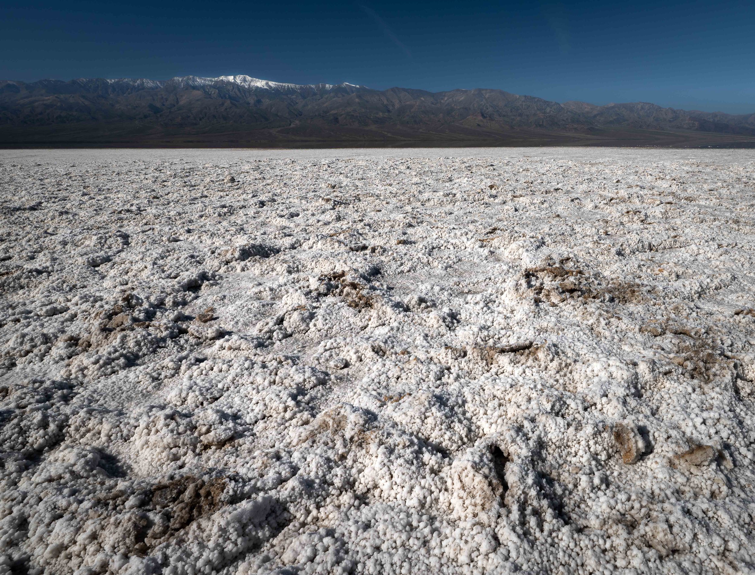
282 feet below sea level — the vast salt flats of Badwater Basin stretch to the horizon, the Panamint Range rising in silence beyond. The small white sign on the cliffside marks sea level far above
Standing at Badwater Basin, it's worth pausing to absorb what you're actually experiencing: this is the lowest point in North America, a place where an ancient sea evaporated and left behind a landscape of pure white salt that extends nearly 200 square miles.
The salt flat itself is composed of sodium chloride, calcite, and gypsum, deposited over millions of years as the valley's lake system dried up. The surface takes on different characters depending on the season and recent rainfall. In dry conditions, the salt cracks into irregular polygons, each one outlined by a raised ridge of crystals, a pattern that stretches to the horizon with mesmerizing consistency. After rare winter rains, a shallow layer of water floods the flat, turning it into a mirror that reflects the Panamint Mountains and the sky above with breathtaking clarity.
That reflected sky is one of Death Valley's most sought-after photographic moments. If you're lucky enough to visit after rainfall, the reflection shots at Badwater are among the most spectacular in the American Southwest. The trick is positioning, getting the camera as close to the water surface as possible to maximize the mirror effect.
Even in dry conditions, the graphic quality of the salt polygons makes for powerful abstract compositions. Walk out onto the flat (it's permitted and well worth it) and let the patterns lead your eye. The scale is deceiving. What looks like a short walk to clear space is often much farther. Take your time.
The small white sign mounted high on the cliff face beside the parking area marks sea level, a quietly staggering reminder of just how far below the world you're standing.
Artist's Palette: Where Geology Becomes Art
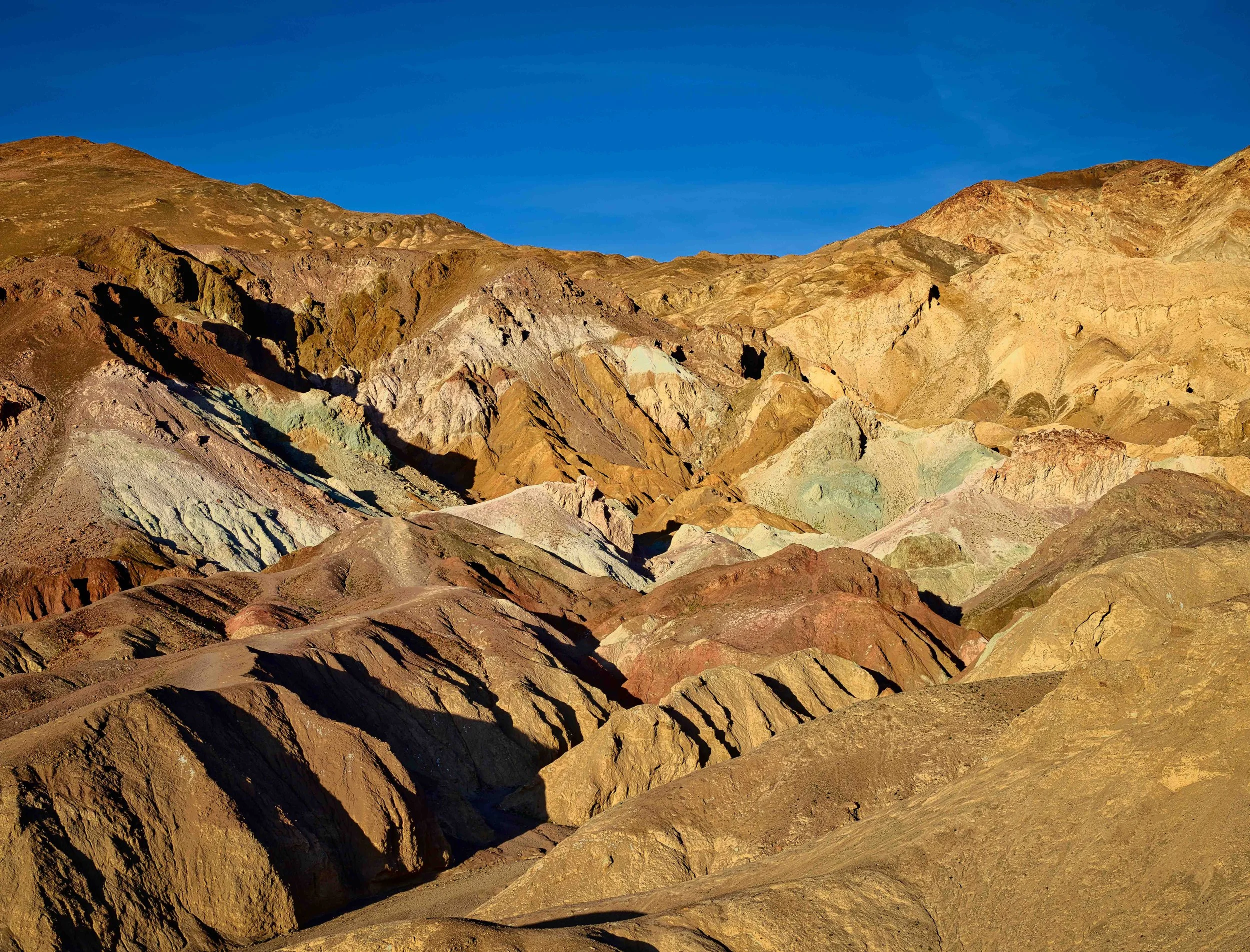
A canvas painted by volcanic chemistry — the hillsides of Artist's Palette blaze in shades of green, pink, purple, red, and gold as afternoon light saturates the mineral-rich deposits.
Drive the one-way Artist's Drive loop and you'll encounter one of the most visually surprising landscapes in any national park. The hillsides here are streaked in an improbable palette of colors: vivid greens, deep burgundy, soft pink, bright yellow, and chalky purple, all layered and swirled across the volcanic deposits like brushstrokes on a canvas. This is no illusion or photographic trick. It is simply raw geology in full display.
The colors are the result of oxidized metalite minerals within ancient volcanic deposits. Different minerals produce different colors: decomposed tuff creates the greens, iron oxides produce the reds and pinks, manganese brings out the purples, and other volcanic compounds contribute the yellows and creams. The lack of vegetation means there is nothing to soften or obscure these colors. The hillside reads as pure, saturated mineral tone.
The best light for photography here is the late afternoon, roughly two hours before sunset. The warm directional light enhances the warm tones (reds, oranges, yellows) while casting subtle shadows that define the surface texture of the hills. Midday light flattens the scene considerably.
A telephoto lens works beautifully here, compressing the layers of color and texture into dense, abstract compositions. But don't neglect the wider view. The sweep of the entire hillside against a deep blue sky can be just as striking. Polarizing filters are particularly useful to saturate the colors further and reduce any glare from the mineral surfaces.
This is one of those locations where the temptation is to simply stand and stare. Do that first. Then raise the camera.
Mesquite Flat Sand Dunes: The Desert of Imagination
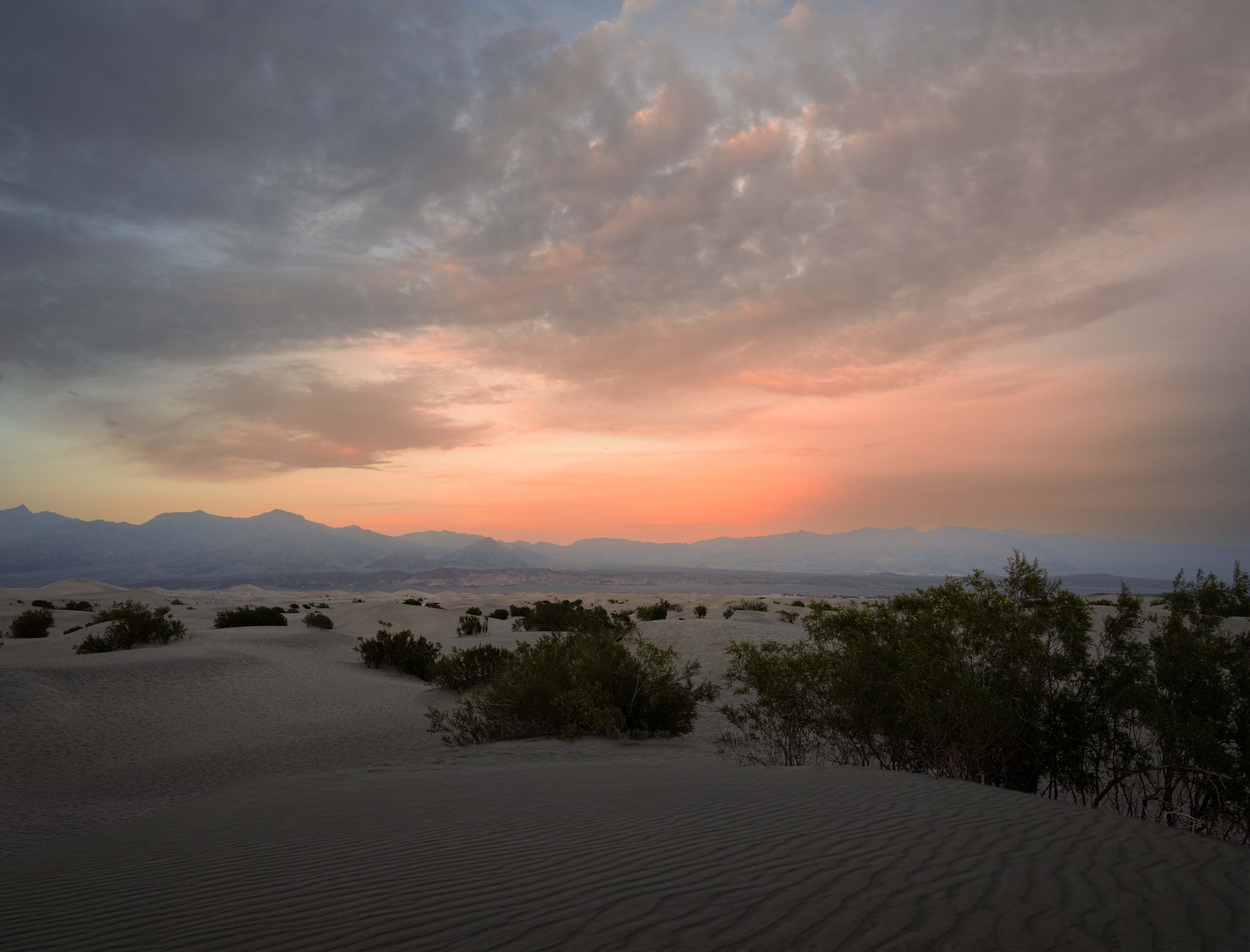
Last light over Mesquite Flat — the dunes catch every shade of orange and amber as the sun sinks toward the Cottonwood Mountains, the windswept ridgelines sharp as blades.
When most people picture a desert, they picture something like Mesquite Flat. Rising from the valley floor near Stovepipe Wells, these golden sand dunes are the most accessible and most photographed in the park and for good reason. They offer everything a photographer could want sweeping curves, crisp shadow lines, wind-sculpted ridges, and some of the most reliably beautiful sunset light in the American West.
The dunes rise to about 100 feet at their highest point and cover roughly 14 square miles. They are formed and constantly reshaped by the complex wind patterns that flow through the surrounding mountain passes. A strong overnight wind can completely erase footprints and reset the dunes' surfaces to a smooth, unmarked perfection. One of the reasons early morning visits often yield the cleanest compositions.
Sunset is the signature experience here. As the sun drops toward the Cottonwood Mountains to the west, the raking light carves the dune ridges into sharp contrast, bright, glowing orange on the lit side, deep shadow in the troughs. The transition between light and shadow is the composition. Look for the sinuous curves of the dune crests and let them lead the eye through the frame.
Getting deep into the dunes before the light fades is essential. The outer edges near the parking area are often trafficked and show footprints. Plan to walk 15 to 20 minutes into the field to find clean, untouched surfaces. Bring water, watch the light, and be prepared to move quickly as the sun drops.
Sunrise here is equally rewarding and sees far fewer visitors. The cool blue dawn light creates a completely different mood, quieter, more meditative before the first warm rays ignite the crests.
Final Thoughts
Death Valley rewards those who plan but also those who stay flexible. Conditions change rapidly, a cloud bank at sunrise can ruin a shot at Zabriskie Point but create something magical at Badwater. The best images from this place tend to come from photographers who are present for the light, not just positioned for it.
Heat management is not optional. Even in cooler months, midday temperatures can be extreme. Carry more water than you think you need, protect your gear from dust and direct sun, and be honest about your limits. The most dramatic light, sunrise and sunset, also happens to coincide with the most comfortable temperatures.
Come with an open agenda, a charged battery, and a willingness to be surprised. Death Valley has a way of giving you exactly what you didn't plan for, and it is almost always worth the frame.
Comments are always welcome.
You can see more images from Death Valley National Park on my website at the following link.